
Chaukhamba (7,138 m): The Four Pillars of Garhwal
Four pillars of ice at the head of the Gangotri glacier.
Chaukhamba is a wall of four summits west of Badrinath, and Chaukhamba I at 7,138 m is the highest peak of the Gangotri group. Here are all four with their heights, the glaciers it feeds, the route camp by camp, how dangerous the climb is, the 2026 permit status and the story from the 1952 first ascent to the 2024 helicopter rescue.
- 7,138 m Chaukhamba I (23,419 ft)
- 4 summits 6,854–7,138 m
- 13 Jun 1952 first ascent
- May–Jun Sep–Oct
- 2026 open (Uttarakhand list)
Mountains of India › Uttarakhand › Chaukhamba
Last verified 18 Nov 2026
How high is Chaukhamba, and where is it?
Chaukhamba is a massif of four summits in the Garhwal Himalaya of Uttarakhand, west of Badrinath. The highest, Chaukhamba I, is 7,138 m (23,419 ft), the top of the Gangotri group, and the Gangotri glacier rises on its north-western slopes. The name means “four pillars”. It was first climbed on 13 June 1952. See all 7,000 m peaks in India.
Status, checked 18 November 2026: open. The “Chaukhamba group” is named in the list of 83 peaks that Uttarakhand opened on 4 February 2026. Indian climbers apply on the state’s UKMPS portal and pay no state fees in 2026; foreign teams pay only the IMF fees. We found no closure order since.
Four pillars on one ridge. Chaukhamba means “four pillars”, for the four summits that stand in a line on a north-east to south-west ridge. The main summit, Chaukhamba I, is at the north-east end; the heights of all four are in the four pillars table below. The massif rises 1,594 m above its key col at Mana Pass, which makes it an ultra-prominent peak.
Where the Ganga’s glacier begins. Chaukhamba stands above three glaciers: the Gangotri, the Bhagirathi Kharak and the Satopanth. The Gangotri glacier, the source of the Bhagirathi, rises on its north-western slopes, and the Satopanth glacier links it to Satopanth (7,075 m). For the wider picture, read our Indian Himalaya guide, the highest peaks in Uttarakhand and the full list of India’s highest peaks.
The route to Chaukhamba I, camp by camp
From Badrinath, up the Bhagirathi Kharak glacier. The first ascent in 1952 and the 2022 solo climb both came from the north-east side. The road ends at Badrinath, at about 3,300 m. Base camp sits at the fork of the Bhagirathi Kharak glacier at 4,627 m, about five days from the road. In 1952 the summit team climbed the north-east face from a high camp at about 5,950 m.
The 1952 line on the north face is described today as no longer practicable, and the north flank as very dangerous. In 2001 an Indian team climbing from Badrinath had its Camp 3 at 6,350 m; an avalanche hit that camp. Later climbers have used the north-east ridge.
The west side is reached from Gangotri and Gaumukh: a 2004 team put base camp at about 4,900 m where the Swachand glacier meets the Gangotri glacier. Camp heights change from year to year. No official itinerary exists; about four weeks from the road-head is a fair estimate.
| Camp / point | Altitude | Notes |
|---|---|---|
| Badrinath | 3,300 m / 10,827 ft | Road-head (about 3,300 m); Mana village lies beyond |
| Base camp | 4,627 m / 15,180 ft | Fork of the Bhagirathi Kharak glacier, about five days from the road (2022) |
| High camp | 5,950 m / 19,521 ft | The 1952 summit camp (about 5,950 m) |
| Camp 3 | 6,350 m / 20,833 ft | The 2001 line; hit by an avalanche that year |
| Chaukhamba I summit | 7,138 m / 23,419 ft | North-east face (1952) or north-east ridge (2022); flat summit plateau |
How a Chaukhamba expedition unfolds
- Stage 1 · Road to BadrinathThe road to Badrinath, the road-head at about 3,300 m, with time to acclimatise.
- Stage 2 · Walk to base campAbout five days up the valley to base camp at the Bhagirathi Kharak glacier fork, 4,627 m.
- Stage 3 · Stock the campsLoad carries and fixed rope towards a high camp near 6,000 m, sleeping high and coming back down.
- Stage 4 · Summit pushFrom the high camp up the north-east side to the 7,138 m summit plateau, then down the fixed lines.
- Stage 5 · Weather days and the walk outSpare days for snow and wind, then clearing the camps and the walk back to Badrinath.
Itineraries vary with the outfitter, group and weather; rest days are added when needed.
How hard is it to climb Chaukhamba?
Our dataset grades Chaukhamba I technical. It is a full expedition above 7,000 m, and the record shows real danger: avalanches and rockfall on the north side, an avalanche that killed two climbers at Camp 3 in 2001, and a three-day ordeal on Chaukhamba III in October 2024 that ended with an Indian Air Force rescue.
Arrive with at least one earlier summit above 6,000 m and solid fixed-rope and glacier skills. In Himachal, good steps towards a peak like this are Deo Tibba (6,001 m), Mulkila (6,517 m) and Reo Purgyil (6,816 m). Read our altitude sickness guide before you go high.
- ExperienceAt least one summit above 6,000 m and days on crevassed glaciers.
- TechniqueCrampons and ice axe on steep snow and ice, fixed ropes, jumaring, abseiling and crevasse rescue.
- FitnessRepeated load carries between camps and a long summit day near 7,000 m.
- JudgementReading avalanche slopes and fresh snow, and the discipline to turn back.
- TrainingA Basic and an Advanced Mountaineering Course; Indian teams also follow IMF rules on team qualifications.
Best time to climb Chaukhamba
May to June and September to October. The recorded climbs fit those windows: the first ascent on 13 June 1952 and the Korean ascent of Chaukhamba II on 14 May 1996. The October 2024 rescue shows that autumn weather can still turn fast at 6,000 m.
July and August are monsoon months in Garhwal. Our best time for mountaineering in India guide compares the seasons region by region.
| Jan | Feb | Mar | Apr | May | Jun | Jul | Aug | Sep | Oct | Nov | Dec |
BestPossibleClosed / not advised
Permits for Chaukhamba in 2026
Indian climbers apply on Uttarakhand’s UKMPS portal. The Chaukhamba group is on the state’s February 2026 list of 83 open peaks, and all state fees are waived for Indian climbers in 2026. IMF rules for Indian teams still apply.
Foreign nationals need IMF permission, with a liaison officer and insurance. Chaukhamba I and II are above 7,000 m, where the IMF base fee is US$1,000 for a team of two, plus US$500 for liaison-officer equipment, and per-member charges apply; Chaukhamba III and IV fall in the 6,501–7,000 m band (US$700) (IMF peak-fee page, as of 1 Oct 2026). More in our IMF permit and peak fees guide and mountaineering in India for foreign climbers.
The west approach from Gaumukh lies inside Gangotri National Park; park entry is arranged with the expedition permit.
What to pack
- Insulated mountaineering boots rated for 7,000 m and above, with crampons
- A mountaineering ice axe, a jumar (ascender) and a descender
- Climbing harness, helmet, carabiners and slings
- Down suit or heavy down jacket, and a sleeping bag for −25 °C or colder
- Windproof and waterproof shell jacket and trousers
- Summit mitts plus liner gloves
- Glacier sunglasses (UV400), goggles and sunscreen
- Headlamp with spare batteries for the pre-dawn start
- Trekking poles for the walk-in to base camp
- Two insulated water bottles and a personal first-aid kit
Climbing history of Chaukhamba
1938 and 1939: the first attempts on Chaukhamba failed.
13 June 1952: Lucien George and Victor Russenberger, Swiss members of a French expedition led by E. Frendo, made the first ascent of Chaukhamba I by the north-east face from the Bhagirathi Kharak glacier, starting from a high camp at about 5,950 m.
1995: a team of instructors from the Nehru Institute of Mountaineering, led by Col M.P. Yadav, climbed Chaukhamba I by the west face and made the first ascent of Chaukhamba II. 1996: the Garhwal Rifles climbed Chaukhamba I by the south-west face, and on 14 May a Korean team made the second ascent of Chaukhamba II by the north-west ridge.
2001: an Indian expedition from Badrinath lost two members when an avalanche hit Camp 3 at 6,350 m. 2004: a Nehru Institute team tried Chaukhamba III and IV from the Gangotri side and reached about 6,300 m.
2022: Boris Textor climbed Chaukhamba I solo by the north-east ridge, reaching it by the left side of the north face; his GPS read 7,136 m on top.
October 2024: two foreign women climbers, one American and one British, were stranded at about 6,015 m on Chaukhamba III after losing their food and gear. A French team found them on 5 October, and Indian Air Force helicopters lifted them to Joshimath on 6 October. February 2026: the Chaukhamba group was named in Uttarakhand’s list of 83 opened peaks.
The four Chaukhamba summits and their heights
The four summits stand in a line from north-east to south-west, with the highest at the north-east end. Only Chaukhamba I is in our dataset of India’s peaks; the other heights are the commonly published figures.
| Summit | Height | What we know |
|---|---|---|
| Chaukhamba I | 7,138 m / 23,419 ft | First ascent 13 Jun 1952, north-east face; west face 1995; south-west face 1996 |
| Chaukhamba II | 7,070 m / 23,196 ft | First ascent 1995, Nehru Institute of Mountaineering team; second ascent 14 May 1996, Korean team, north-west ridge |
| Chaukhamba III | about 6,990 m / 22,930 ft | Published as 6,995 m; the Himalayan Journal gives 6,974 m. Site of the October 2024 rescue |
| Chaukhamba IV | 6,854 m / 22,487 ft | A 2004 attempt on III and IV from the Gangotri side reached about 6,300 m |
Chaukhamba and the Gangotri glacier
Chaukhamba is the highest point of the Gangotri group. The Gangotri glacier, the source of the Bhagirathi, rises on its north-western slopes. The Bhagirathi Kharak and Satopanth glaciers lie on its other flanks, and the Satopanth glacier links it to Satopanth peak.
That is why the peak has two ways in: from Gangotri and Gaumukh on the west, inside Gangotri National Park, and from Badrinath on the east. For other Garhwal giants, see Shivling (6,543 m) and Kamet (7,756 m).
Other Uttarakhand peaks of a similar height
-
Uttarakhand7,151 m23,461 ft
Hardeol
-
 Uttarakhand
7,120 m23,360 ft
Trisul I
-
Uttarakhand
7,075 m23,212 ft
Satopanth
-
Uttarakhand7,074 m23,209 ft
Tirsuli
Chaukhamba: questions people ask
What is the height of Chaukhamba?
Chaukhamba I, the highest of its four summits, is 7,138 m (23,419 ft). The other three are Chaukhamba II (7,070 m), III (about 6,990 m) and IV (6,854 m).
Why is it called Chaukhamba?
Chaukhamba means “four pillars”, for the four summits that stand in a line on one ridge.
Where is Chaukhamba?
In the Garhwal Himalaya of Uttarakhand, west of Badrinath, at the head of the Gangotri glacier. It is the highest peak of the Gangotri group.
Which glacier starts from Chaukhamba?
The Gangotri glacier, the source of the Bhagirathi, rises on Chaukhamba’s north-western slopes.
Who first climbed Chaukhamba?
Lucien George and Victor Russenberger, Swiss members of a French expedition, reached the summit of Chaukhamba I on 13 June 1952 by the north-east face.
Is Chaukhamba open for climbing in 2026?
Yes. The Chaukhamba group is on Uttarakhand’s February 2026 list of 83 opened peaks. Indian climbers apply on the UKMPS portal with no state fees; foreign teams apply through the IMF.
How difficult is Chaukhamba?
It is a technical expedition above 7,000 m with avalanche and rockfall danger; the north flank is described as very dangerous. Climbers need an earlier 6,000 m summit and mountaineering training.
What happened on Chaukhamba III in 2024?
Two foreign women climbers were stranded at about 6,015 m for three days after losing their food and gear. Indian Air Force helicopters rescued them on 6 October 2024.
Dreaming of peaks like Chaukhamba? Start in Himachal
Suzu arranges climbs in Himachal only, so we do not sell Chaukhamba. If a 7,000 m peak is your goal, Himachal climbs build the record it needs: Friendship Peak or Yunam first, then Deo Tibba, Mulkila or Reo Purgyil. Tell us your dates, team size and experience, and we pair you with a registered Himachal outfitter and certified guides. Price: Get Quote.
Keep exploring
 Peaks of Uttarakhand63 peaks · Nanda Devi 7,816 m to Nag TibbaNun Kun7,135 m · the twin giants above Kargil's Suru valleyPanchachuli6,904 m · the five peaks of KumaonManirang6,593 m · an Ultra on the Spiti–Kinnaur border, above ManeMountains of IndiaRecords, permits and trainingHighest peaks in IndiaFull list of 163 peaksGuided peak climbsFriendship Peak to Deo Tibba
Sources
- Wikipedia — Chaukhamba
- Uttarakhand Forest Department — Chaukhamba
- Himalayan Journal 61 — Chaukhamba: the mountain on the far horizon
- American Alpine Journal 2023 — Chaukhamba I, north-east ridge (2022)
- The Statesman (Oct 2024) — IAF choppers rescue women mountaineers near Chaukhamba III
- The Week (6 Oct 2024) — stranded mountaineers rescued
- The NewsMill (Feb 2026) — Uttarakhand opens 83 Himalayan peaks
- Uttarakhand UKMPS — apply for a mountaineering permit
- Indian Mountaineering Foundation — peak fees for foreign expeditions
Photo credits
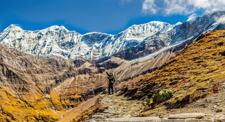
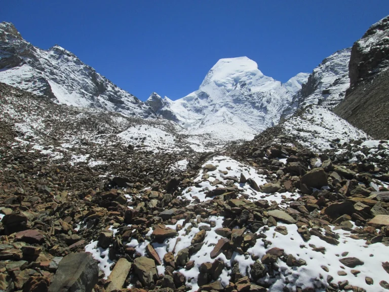
Trisul above autumn slopes — Photo: Shaswat Nimesh, CC BY-SA 4.0 · Satopanth above the Gangotri moraines — Photo: Asish Das75, CC BY-SA 4.0 · Nanda Devi above the Garhwal ridges — Photo: Harshit SR, CC BY-SA 4.0