
Manirang (6,593 m), Spiti: Route & Expedition Guide
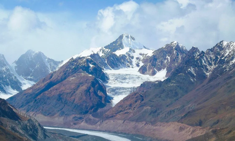
The big snow peak above Mane village.
An Ultra on the Spiti–Kinnaur border, climbed from Mane in Spiti past the old Manirang Pass trade route and up a long snow ridge. Mostly non-technical, but high, long and with brittle ice and loose rock near the top.
- 6,593 m summit (21,631 ft)
- 2–3 weeks from Manali (estimate)
- Jun–Sep season
- Ultra 1,727 m prominence
- Price Get Quote
Mountains of India › Himachal Pradesh › Manirang
Last verified 12 Nov 2026
What is Manirang, and how do you climb it?
Manirang (6,593 m / 21,631 ft) is an Ultra-prominent peak on the Spiti–Kinnaur border in Himachal Pradesh. Climbers start at Mane village in Spiti, camp near the 5,550 m Manirang Pass and follow a long, narrow snow ridge to the top. It is mostly non-technical but high and long. Climb it from June to September. See all the 6,000 m peaks of India.
Manirang rises on the watershed between Spiti and Kinnaur in Himachal Pradesh, above Mane village on the Spiti side and the Ropa valley on the Kinnaur side. At 6,593 m (21,631 ft), with 1,727 m of prominence, it is an Ultra: one of the few peaks in the state that stands so far above its surroundings. Government expedition notes give 21,625 ft; we use 6,593 m, the figure in the Himalayan Journal and the Alpine Journal.
It looks like a big, friendly snow peak, and much of it is. But Paul Nunn, who made the third ascent in 1994, wrote that the mountain he had ‘supposed an easy peak’ held a 350 m band of hard, brittle ice, abseils over loose rock and a long, narrow snow ridge at the top. This page sets out the Mane-side route with approximate camp altitudes, the Manirang Pass, the season, the permits and the climbing history from 1952 to 2024. For the wider picture, see our Indian Himalaya guide, the full list of India’s highest peaks and our guide to the peaks of Himachal Pradesh.
Route from Mane, camp by camp
From Manali the road crosses the Kunzum Pass (or comes up from Shimla through Kinnaur) to Kaza, then down the Spiti valley to Mane (about 3,600 m), a village split into upper and lower parts. The walk starts with a crossing of the Spiti river and climbs to the grazing ground of Saponang (about 4,500 m), which the Himalayan Journal calls base camp.
The 1994 Indo-British team carried on to a camp at about 4,840 m and a base not far below the Manirang Pass at about 5,360 m. Camp 1 (about 5,700 m) was the 1988 Army site; Camp 2 (about 6,050 m) sits in a hollow behind a limestone tower on the ridge. On summit day the 1994 pair left Camp 2 at about 4:30 a.m. and reached the top between about 9:45 and 10:15 along the narrow snow summit ridge. Teams place camps differently, so the heights below are approximate.
| Camp / point | Altitude | Notes |
|---|---|---|
| Mane | 3,600 m / 11,811 ft | Road-head village in Spiti, reached via Kaza; the route crosses the Spiti river |
| Saponang | 4,500 m / 14,764 ft | Grazing ground; the Himalayan Journal calls it base camp (about 4,500 m) |
| Camp | 4,840 m / 15,879 ft | Intermediate camp on the 1994 route (about 4,840 m) |
| Base camp | 5,360 m / 17,585 ft | Not far below the Manirang Pass (about 5,360 m) |
| Camp 1 | 5,700 m / 18,701 ft | The 1988 Army camp site (about 5,700 m) |
| Camp 2 | 6,050 m / 19,849 ft | Hollow behind a limestone tower on the ridge (about 6,050 m) |
| Manirang summit | 6,593 m / 21,631 ft | Along a long, narrow snow ridge; about 5–6 hours up from Camp 2 in 1994 |
A typical plan (estimate, not a fixed schedule)
- Days 1–2 · ManaliArrive, sort permits, police registration and gear, and rest.
- Days 3–4 · Manali to Kaza and ManeDrive over the Kunzum Pass to Kaza and on to Mane, with a night to acclimatise.
- Days 5–6 · Mane to SaponangCross the Spiti river and climb to the Saponang grazing ground, about 4,500 m.
- Days 7–9 · Up to base campThrough the camp at about 4,840 m to base camp below the Manirang Pass, about 5,360 m, with a rest day.
- Days 10–12 · Camp 1 and Camp 2Load ferries to Camp 1 (about 5,700 m) and Camp 2 (about 6,050 m) on the ridge.
- Day 13 · Summit dayA pre-dawn start along the summit ridge to 6,593 m, then down to a lower camp.
- Days 14–16 · Spare daysKept for weather, a second attempt and a careful descent.
- Days 17–18 · Back to ManaliWalk out to Mane and drive back via Kaza.
Itineraries vary with the outfitter, group and weather; rest days are added when needed.
How hard is Manirang?
Manirang is graded moderate: most of the route is glacier walking and snow-ridge climbing rather than steep technical ground. Do not mistake that for easy. It is a 6,593 m summit with a long approach, and the 1994 ascent met a 350 m section of hard, brittle ice, abseils over loose rock on the descent and a narrow snow ridge at the top. The Himalayan Journal describes the rock as crumbly. The 1988 Army expedition put 7 of its 30 climbers on top.
Come with a 5,000–6,000 m climb behind you and confident crampon and rope skills. If you are building up to it, start with Yunam or Friendship Peak, read our guide to climbing your first 6,000 m peak, and plan your acclimatisation with our altitude sickness guide.
- ExperienceAn earlier high summit (5,000–6,000 m) or a solid record on glaciated peaks.
- TechniqueCrampons and ice axe on hard ice, moving roped on a glacier and abseiling.
- FitnessA long approach from Mane, load carries to two high camps and a long summit day.
- AcclimatisationNights in Kaza and Mane and rest days at Saponang and base camp.
- TrainingA Basic Mountaineering Course; Indian teams also follow IMF rules on team qualifications.
Best time to climb Manirang
June to September. Spiti lies in the Himalayan rain shadow, and the recorded ascents span the whole window: June (2024), July (1994), August (2021), September (1952) and autumn (1988).
The monsoon still reaches the border ridge: the 1994 team met afternoon storms by July. Start summit days early, and keep spare days for fresh snow and bad weather.
| Jan | Feb | Mar | Apr | May | Jun | Jul | Aug | Sep | Oct | Nov | Dec |
BestPossibleClosed / not advised
Permits for Manirang
Indian climbers need permission from the Indian Mountaineering Foundation (IMF) for an expedition. In Himachal, climbs go through an HP Tourism-registered outfitter with registered guides, with police registration and insurance for every member under the state’s adventure rules.
Foreign nationals can climb Manirang with IMF permission, applied for at least 90 days ahead, a liaison officer and insurance. At 6,593 m it falls in the 6,501–7,000 m band: a base fee of US$700 for a team of two, plus per-member charges and US$500 for liaison-officer equipment (IMF peak-fee page, checked Oct 2026). The Protected Area Permit depends on the side: Kaza and the Manali–Kunzum–Kaza road are not on Himachal’s list and Mane is not listed either, but Ropa, Sunnam and the rest of Kinnaur’s Pooh block are. So the Mane approach needs no PAP, while coming up from Kinnaur or crossing the pass to Ropa does. Visa rules can change, so confirm with the Indian mission. More in our IMF permit and peak fee guide and our guide to mountaineering in India for foreign climbers.
What a guided Manirang expedition includes
The price depends on your dates, group size, nationality and experience, so we quote each expedition. Tell us your dates and climbing record on WhatsApp and you get one plan and one quote; we pair you with a registered Himachal outfitter and certified guides. Foreign nationals also pay the IMF fee and liaison-officer charges, shown separately.
- Certified mountaineering guides and support staff
- Tents, camps and all meals on the mountain
- Group climbing equipment (ropes, fixed lines and anchors)
- Help with IMF permission and permit paperwork
- Transfers from Manali to Mane and back
- Acclimatisation and weather days in the plan
What to pack
- Insulated mountaineering boots that take crampons
- Crampons, an ice axe and a jumar (ascender)
- Climbing harness, helmet, carabiners, slings and a belay or abseil device
- Expedition down jacket and a sleeping bag rated well below −15 °C
- Windproof and waterproof shell jacket and trousers
- Summit mitts plus liner gloves
- Glacier sunglasses (UV400), goggles and sunscreen
- Headlamp with spare batteries
- Trekking poles for the long walk-in
- Two water bottles and a personal first-aid kit
Climbing history of Manirang
The first ascent was made on 12 September 1952 by Dr J. de V. Graaff, Clare Graaff, Pasang Dawa Lama and Tashi Sherpa. The mountain then waited 36 years for a second ascent: in autumn 1988 an Indian Army Parachute Regiment expedition led by Lt Col Balwant Sandhu put 7 of its 30 climbers on top. On 10 July 1994, Paul Nunn and Divyesh Muni of the Indo-British Kinnaur expedition made the third ascent; the same trip made the first ascents of Saponang (5,836 m) and Ghunsarang (5,800 m). A 1986 party led by Harish Kapadia climbed Manirang South (5,888 m), a separate summit about 2 km away, not the main peak.
In recent years Manirang has become a peak for government teams. An all-women Indian Air Force team led by Wg Cdr Bhavana Mehra reached the summit on 15 August 2021. The NDRF expedition ‘Vijay’, flagged off on 1 June 2024 under Dy Cmdt Nitesh Sharma, reported its summit on 16 June 2024 and was received by the Home Ministry on 29 June.
The Manirang Pass (5,550 m)
Below the peak lies the Manirang Pass, 5,550 m (18,209 ft); a 1986 Himalayan Journal account put it at about 5,600 m. Locally it is also called Ropakla. For generations it was a trade route between Spiti and the Ropa valley of Kinnaur, whose last village, Ropa, stands at 2,925 m. The trade has long stopped and the crossing is now a high trek.
On the climb, base camp sits not far below the pass. Crossing it to Ropa takes you into Kinnaur’s Pooh block, a protected area, so foreign trekkers and climbers need a Protected Area Permit for that side (see the permits section above).
Other Himachal Pradesh peaks of a similar height
-
Himachal Pradesh6,633 m21,762 ft
Parvati Parbat
-
 Himachal Pradesh
6,517 m21,381 ft
Mulkila
-
Himachal Pradesh6,473 m21,237 ft
Jorkanden
-
Himachal Pradesh6,451 m21,165 ft
Papsura
Manirang: questions people ask
How high is Manirang peak?
6,593 m (21,631 ft). Some expedition reports give 21,625 ft.
Where is Manirang?
On the Spiti–Kinnaur border in Himachal Pradesh, above Mane village in Spiti, with the Ropa valley of Kinnaur on the other side.
Who first climbed Manirang?
Dr J. de V. Graaff, Clare Graaff, Pasang Dawa Lama and Tashi Sherpa, on 12 September 1952.
What is the Manirang Pass?
A 5,550 m pass below the peak, once the trade route between Spiti and Kinnaur’s Ropa valley. It is now a trekking crossing.
Is Manirang difficult to climb?
It is graded moderate: mostly non-technical glacier and ridge climbing, but high and long, with brittle ice and loose rock near the top.
What is the best time to climb Manirang?
June to September. Spiti is in the rain shadow, but afternoon storms can reach the ridge in July and August.
Do foreigners need a permit for Manirang?
Yes: IMF permission (US$700 base for a team of two in the 6,501–7,000 m band, Oct 2026) and a liaison officer. A Protected Area Permit is needed only if the route enters Kinnaur’s Pooh block, such as Ropa.
Which teams have climbed Manirang recently?
An all-women Indian Air Force team in August 2021 and the NDRF expedition ‘Vijay’ in June 2024.
Plan this climb with Suzu
We pair you with a registered Himachal outfitter and certified guides, sort the permits and add hotel and transfers — one plan, one quote.
Keep exploring
 Reo Purgyil6,816 m · the highest peak in Himachal, above NakoDeo Tibba6,001 m · the snow dome above Jagatsukh and the Duhangan Col
 Hanuman Tibba5,982 m · the technical snow pyramid above Beas KundPeaks of Himachal Pradesh28 peaks · Reo Purgyil 6,816 m to ChurdharMountains of IndiaRecords, permits and trainingHighest peaks in IndiaFull list of 161 peaksGuided peak climbsFriendship Peak to Deo Tibba
Sources
- Alpine Journal 1995 — P. Nunn, 'Manirang, 6593m'
- Himalayan Journal 51 — Manirang: a mountain of surprises
- Himalayan Journal 43 — Baspa and Ropa, 1986
- Mount Everest Foundation — Indian-British Kinnaur 1994
- NDRF — flag-off of expedition 'Vijay' to Mt Manirang (2024)
- Aviation Defence Universe — IAF all-women team to Mt Manirang (2021)
- Indian Mountaineering Foundation — peak fees for foreign expeditions
- HP Kinnaur district — tourism guide (protected areas)
- Wikipedia — Manirang
Photo credits
Mulkila and its glacier — Photo: Bharatkaistha, CC BY-SA 4.0 · Leo Pargial and Reo Purgyil — Photo: Arashdeep, CC BY-SA 4.0 · Hanuman Tibba above Solang — Photo: Biswarup Ganguly, CC BY 3.0