
Highest Peak in Every Indian State & UT: All 36, Listed
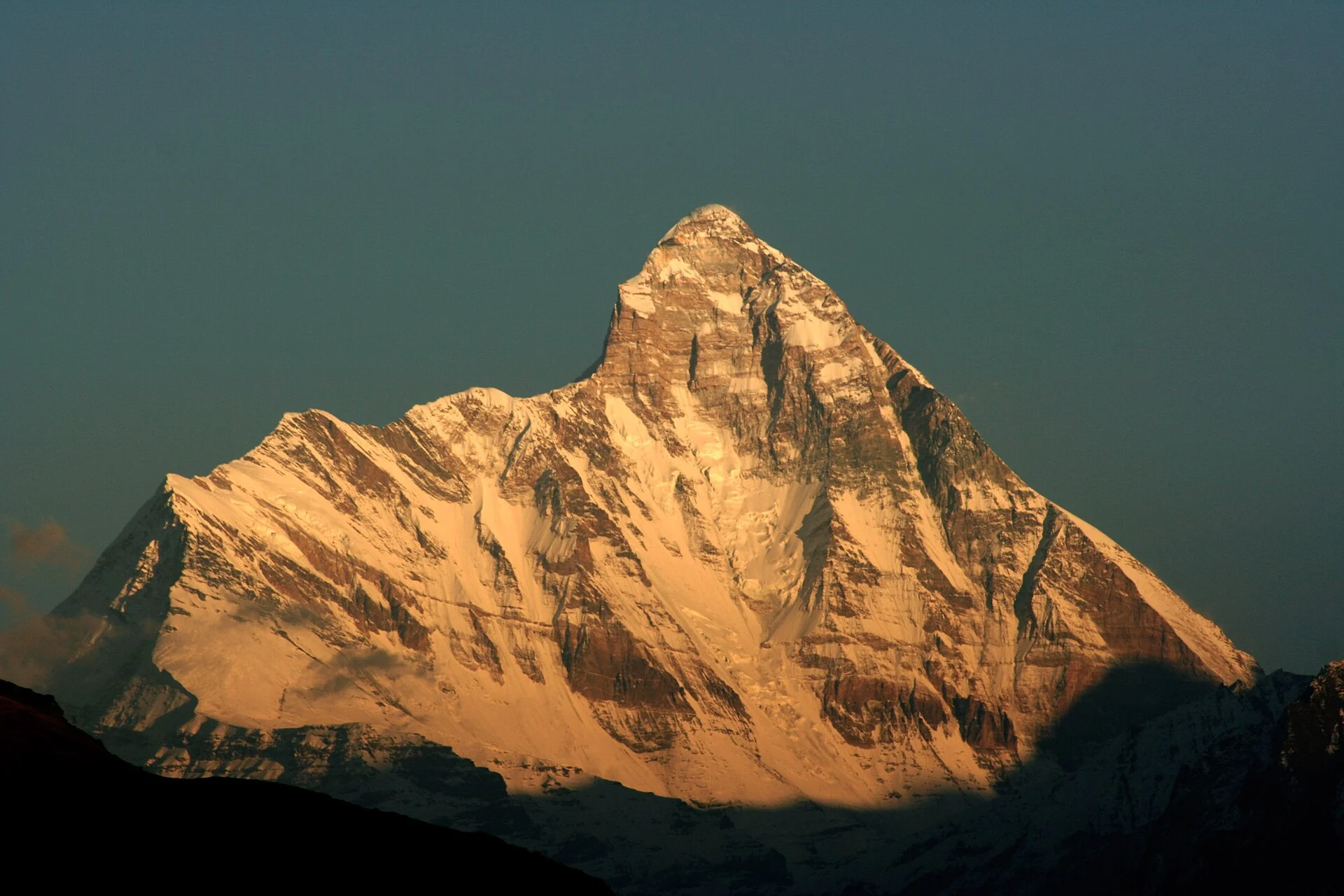
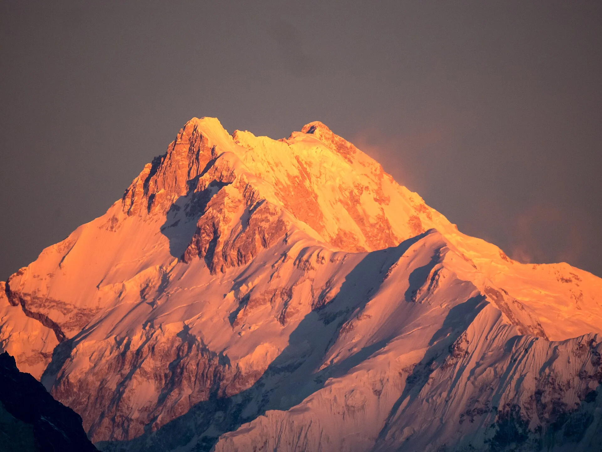 Photo: Johannes Bahrdt, CC BY-SA 4.0
36 high points.
The highest peak of every Indian state and union territory, from Kangchenjunga in Sikkim to an unnamed 15 m point in Lakshadweep, with heights in metres and feet, the tricky answers explained, and what you can actually do at each one.
- 8,586 m Sikkim, Kangchenjunga
- 2,695 m Anamudi, highest in South India
- 1,646 m Kalsubai, Maharashtra
- 15 m Lakshadweep, the lowest
Mountains of India › Highest Peak in Every Indian State & UT
Last verified 7 Nov 2026
What is the highest peak in each Indian state?
Sikkim has India’s highest state summit, Kangchenjunga (8,586 m / 28,169 ft), followed by Uttarakhand’s Nanda Devi and Ladakh’s Saltoro Kangri. Outside the Himalayas, the highest is Kerala’s Anamudi (2,695 m). Karnataka’s top is Mullayanagiri, Maharashtra’s is Kalsubai. All 36 states and UTs are in the table below; the big ones are in our list of the highest peaks in India.
Every Indian state and union territory has a highest point, but they could hardly be more different. Six of them are serious Himalayan summits above 6,800 m; the rest range from Nagaland’s Mount Saramati on the Myanmar border to Delhi’s Deheri on the Aravalli ridge and a 15 m point on a Lakshadweep island.
This page answers the school and exam question (the highest peak of each state) and the traveller’s question (can I go there?) in one place. For the Himalayan giants, see our Indian Himalaya guide and the state pages for Uttarakhand, Ladakh and Himachal Pradesh.
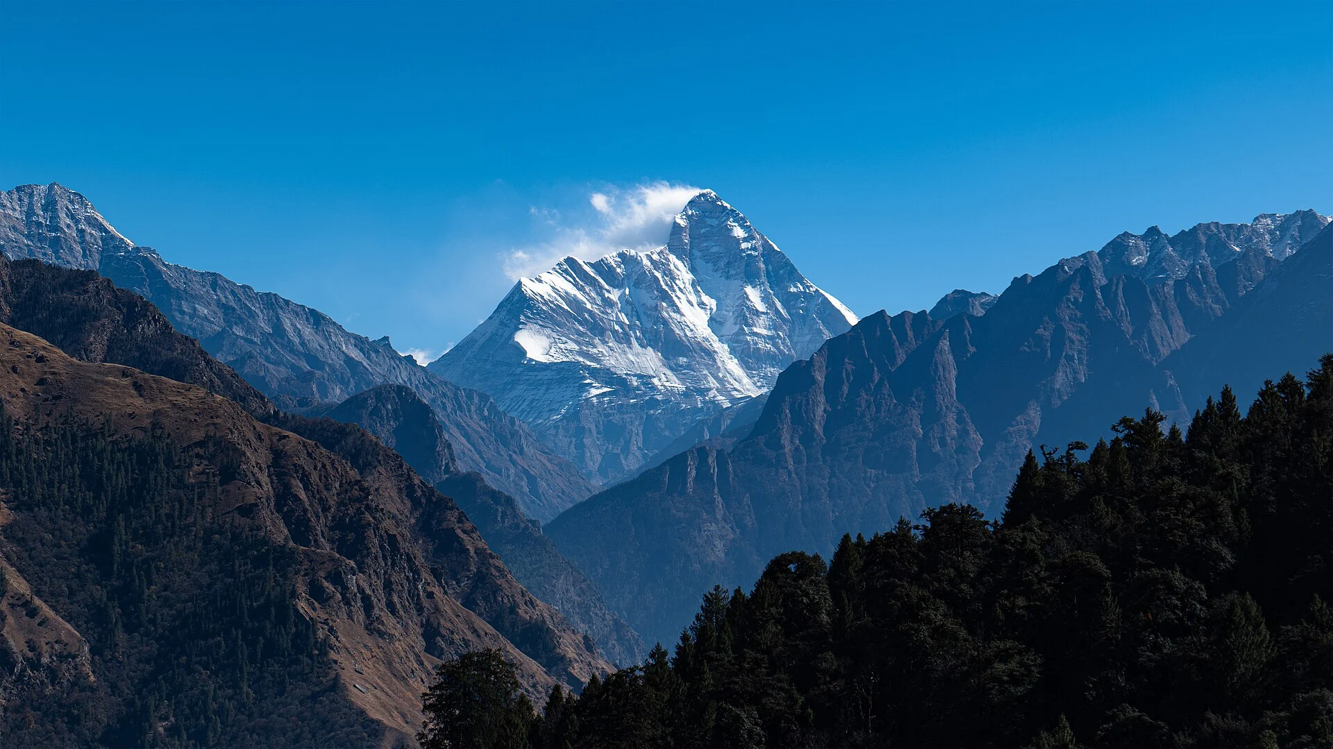
State high points you can see
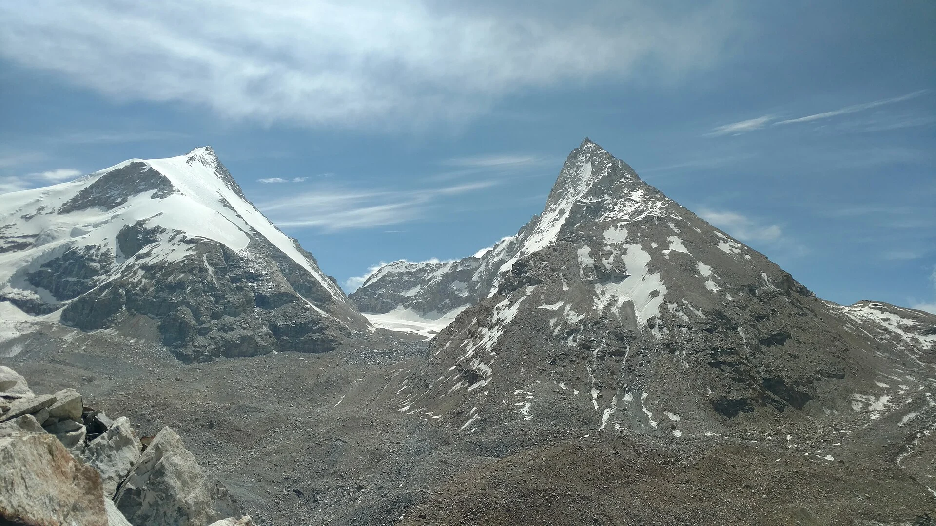
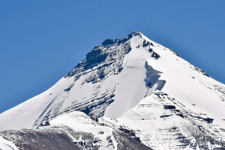
Kangchenjunga (Sikkim), Nanda Devi (Uttarakhand) and Reo Purgyil (Himachal Pradesh) — three of India’s state high points, in real photographs each credited to its photographer.
Highest peak of every Indian state and UT
All 28 states and 8 union territories, ranked by the height of their highest point. Heights for the seven Himalayan high points come from our dataset of Indian peaks; the rest follow the Wikipedia list of states by elevation. Heights for the lower hills vary slightly by source (Mullayanagiri is given as 1,925 or 1,930 m, for example), and several high points are unnamed survey points. Scroll the table sideways on a phone.
| # | State / UT | Highest point & height | Range / where | What it is |
|---|---|---|---|---|
| 1 | Sikkim | Kangchenjunga 8,586 m / 28,169 ft |
Kangchenjunga Himal, India–Nepal border | Sacred; climbing banned from Sikkim since 2001 |
| 2 | Uttarakhand | Nanda Devi 7,816 m / 25,643 ft |
Garhwal Himalaya; highest peak wholly within India | Closed to climbers since 1983 |
| 3 | Ladakh (UT) | Saltoro Kangri 7,742 m / 25,400 ft |
Karakoram, on the AGPL (Siachen) | Restricted military zone |
| 4 | Jammu & Kashmir (UT) | Nun 7,135 m / 23,409 ft |
Nun Kun massif, J&K–Ladakh boundary (Suru valley, Kargil) | Climbed by expeditions |
| 5 | Arunachal Pradesh | Kangto 7,090 m / 23,261 ft |
Eastern Himalaya, India–Tibet border | First recorded ascent 26 Nov 2025 |
| 6 | Himachal Pradesh | Reo Purgyil 6,816 m / 22,362 ft |
Kinnaur, India–Tibet border | Expedition peak; permit for foreigners |
| 7 | Nagaland | Mount Saramati 3,826 m / 12,552 ft |
Patkai Range, India–Myanmar border | Trek |
| 8 | West Bengal | Sandakphu 3,636 m / 11,929 ft |
Singalila Ridge, India–Nepal border (Darjeeling) | Trek or jeep track; Everest and Kangchenjunga view |
| 9 | Manipur | Mount Tempü (Iso) 2,994 m / 9,823 ft |
Nagaland–Manipur border | Trek |
| 10 | Kerala | Anamudi 2,695 m / 8,842 ft |
Western Ghats; Eravikulam National Park (Idukki) | Highest point in India outside the Himalayas; protected park |
| 11 | Tamil Nadu | Doddabetta 2,637 m / 8,652 ft |
Nilgiris, near Ooty | Drive-up viewpoint |
| 12 | Mizoram | Phawngpui (Blue Mountain) 2,157 m / 7,077 ft |
— | National park |
| 13 | Meghalaya | Shillong Peak 1,965 m / 6,447 ft |
East Khasi Hills | Viewpoint |
| 14 | Assam | Unnamed peak 1,960 m / 6,430 ft |
Dima Hasao district | Highest in the Karbi Anglong plateau |
| 15 | Karnataka | Mullayanagiri 1,925 m / 6,316 ft |
Western Ghats, Chikkamagaluru | Short trek; road almost to the top |
| 16 | Rajasthan | Guru Shikhar 1,722 m / 5,650 ft |
Aravalli Range, Mount Abu | Drive-up; temple |
| 17 | Andhra Pradesh | Arma Konda 1,680 m / 5,512 ft |
Eastern Ghats | Trek; highest in the Eastern Ghats |
| 18 | Odisha | Deomali 1,672 m / 5,486 ft |
Eastern Ghats, Koraput | Trek |
| 19 | Maharashtra | Kalsubai 1,646 m / 5,400 ft |
Sahyadri, Ahmednagar–Nashik border | Popular day trek |
| 20 | Haryana | Karoh Peak 1,467 m / 4,813 ft |
Morni Hills, Panchkula | Hike |
| 21 | Jharkhand | Parasnath 1,365 m / 4,478 ft |
Chota Nagpur Plateau | Jain pilgrimage hill (Shikharji) |
| 22 | Madhya Pradesh | Dhupgarh 1,352 m / 4,436 ft |
Satpura Range, Pachmarhi | Sunset viewpoint |
| 23 | Chhattisgarh | Nandiraj 1,276 m / 4,186 ft |
Bailadila hills, Dantewada | — |
| 24 | Gujarat | Girnar 1,145 m / 3,757 ft |
Girnar Hills, Junagadh | Pilgrim steps to the temples |
| 25 | Goa | Sonsogor 1,026 m / 3,366 ft |
Goa–Karnataka border | — |
| 26 | Punjab | Unnamed peak 1,000 m / 3,281 ft |
Shivaliks, Rupnagar district | — |
| 27 | Telangana | Doli Gutta 965 m / 3,166 ft |
Chhattisgarh border | — |
| 28 | Uttar Pradesh | Amsot Peak 957 m / 3,140 ft |
Shivaliks, Saharanpur (Uttarakhand border) | — |
| 29 | Tripura | Betlingchhip 930 m / 3,051 ft |
Jampui Hills | — |
| 30 | Bihar | Someshwar Fort 880 m / 2,887 ft |
Shivalik Hills, West Champaran | — |
| 31 | Andaman & Nicobar (UT) | Saddle Peak 732 m / 2,402 ft |
North Andaman | National park trek |
| 32 | Chandigarh (UT) | Unnamed point near Khuda Ali Sher 479 m / 1,572 ft |
Punjab border | — |
| 33 | Dadra & Nagar Haveli and Daman & Diu (UT) | Unnamed point near Bedpa 465 m / 1,526 ft |
Maharashtra border | — |
| 34 | Delhi (UT) | Deheri 315 m / 1,033 ft |
Aravalli ridge | — |
| 35 | Puducherry (UT) | Unnamed point near Chalakara 67 m / 220 ft |
Mahé, on the Kerala border | — |
| 36 | Lakshadweep (UT) | Unnamed point 15 m / 49 ft |
Agatti Island | The lowest “highest point” in India |
Highest peaks in South India, Maharashtra and the plains states
Most searches for a state’s highest peak come from outside the Himalaya. These are the answers people look for most, from the Western Ghats to the Aravallis.
Highest peak in South India: Anamudi
Anamudi, 2,695 m / 8,842 ft, in Kerala’s Eravikulam National Park (Idukki district), is the highest peak in the Western Ghats and the highest point in India outside the Himalayas. It is also the answer for Kerala. The summit lies inside a protected national park, so check the park’s current rules before planning any visit.
Highest peak in Karnataka: Mullayanagiri
Mullayanagiri, about 1,925 m / 6,316 ft (some sources give 1,930 m), in Chikkamagaluru district. It is the highest point of the Western Ghats north of the Nilgiris. A road runs almost to the top, with a short climb at the end.
Highest peak in Maharashtra: Kalsubai
Kalsubai, 1,646 m / 5,400 ft, in the Sahyadri on the Ahmednagar–Nashik border. The district administration calls it “the Everest of Maharashtra”, and it is one of the state’s most popular day treks.
Highest peak in Tamil Nadu: Doddabetta
Doddabetta, 2,637 m / 8,652 ft, the highest point of the Nilgiris, near Ooty. Unlike Anamudi, you can drive up to its viewpoint.
Rajasthan, Gujarat and Madhya Pradesh
Guru Shikhar (1,722 m / 5,650 ft) at Mount Abu tops the Aravalli Range and Rajasthan. Girnar (1,145 m / 3,757 ft) near Junagadh is Gujarat’s highest, climbed on temple steps. Dhupgarh (1,352 m / 4,436 ft) at Pachmarhi is the top of the Satpuras and of Madhya Pradesh.
The Eastern Ghats and the east
Arma Konda (1,680 m / 5,512 ft) in Andhra Pradesh is the highest peak of the Eastern Ghats; Deomali (1,672 m / 5,486 ft) is Odisha’s highest. In Jharkhand, Parasnath (1,365 m / 4,478 ft) is a Jain pilgrimage hill, also called Shikharji.
Highest peaks of the North-East states
The North-East holds both extremes: one of the highest summits on Earth and some of India’s least-known high points.
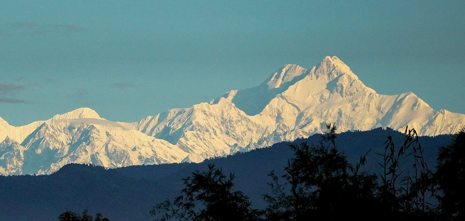
- Sikkim · Kangchenjunga, 8,586 m / 28,169 ftThe highest point of any Indian state and the third-highest mountain in the world. Sikkim treats it as sacred and banned climbing it in 2001, so it cannot be climbed from India. Read our Kangchenjunga guide.
- Arunachal Pradesh · Kangto, 7,090 m / 23,261 ftOn the India–Tibet border. An Indian Army team made the first recorded ascent on 26 November 2025. See the unclimbed and closed peaks page.
- Nagaland · Mount Saramati, 3,826 m / 12,552 ftIn the Patkai Range on the Myanmar border: the highest point in the North-East outside Sikkim and Arunachal.
- Manipur · Mount Tempü (Iso), 2,994 m / 9,823 ftOn the Nagaland–Manipur border.
- Mizoram · Phawngpui, 2,157 m / 7,077 ftThe “Blue Mountain”, inside a national park.
- Meghalaya · Shillong Peak, 1,965 m / 6,447 ftA viewpoint above Shillong in the East Khasi Hills.
- Assam and TripuraAssam’s highest is an unnamed peak of 1,960 m / 6,430 ft in Dima Hasao; Tripura’s is Betlingchhip (930 m / 3,051 ft) in the Jampui Hills.
Four answers that depend on how you ask
“India’s highest peak is K2”
India’s official map shows K2 (8,611 m / 28,251 ft) inside Ladakh, but K2 lies in Pakistan-administered Gilgit-Baltistan. On ground India administers, the highest peak is Kangchenjunga (8,586 m) in Sikkim.
“Ladakh’s highest peak is K2”
For the same reason, lists differ. The highest peak Ladakh actually administers is Saltoro Kangri (7,742 m / 25,400 ft), on the Siachen AGPL. More on our Ladakh peaks page.
“Nun is in Ladakh”
The Nun Kun massif straddles the boundary and is approached from Kargil, but Nun (7,135 m / 23,409 ft) is listed as the highest point of Jammu & Kashmir.
“Nanda Devi is India’s highest”
Only if you mean wholly within India. Nanda Devi (7,816 m / 25,643 ft) is the highest peak entirely inside the country; Kangchenjunga, on the Nepal border, is higher.
Unnamed high points. Six states and UTs (Assam, Punjab, Chandigarh, Dadra & Nagar Haveli and Daman & Diu, Puducherry and Lakshadweep) have no named summit: their highest point is a survey point, so we do not give it a name.
Which state high points can you actually climb?
Only a handful of these 36 high points are real mountaineering objectives, and fewer still are open to climbers.
Closed or restricted
Kangchenjunga (sacred, banned since 2001), Nanda Devi (closed since 1983), Saltoro Kangri (military zone) and Kangto (remote border area, very few attempts).
Expedition peaks
Nun (J&K) is climbed by expeditions from the Suru valley. Reo Purgyil, the highest peak in Himachal Pradesh, is an expedition peak above Nako; foreigners need a Protected Area Permit.
Treks and day hikes
Sandakphu, Saramati, Kalsubai, Mullayanagiri, Arma Konda, Deomali and Saddle Peak are reached on foot. Doddabetta, Guru Shikhar, Shillong Peak and Dhupgarh are drive-up viewpoints.
Want to stand on a real Himalayan summit? Start in Himachal. Friendship Peak (5,289 m) and Yunam Peak (6,111 m) are classic first summits; Reo Purgyil is the state’s big one. We pair you with a registered Himachal outfitter and certified guides.
Seven Himalayan state high points, drawn to scale
Seven states and UTs reach into the Himalaya: Sandakphu (3,636 m, West Bengal), Reo Purgyil (6,816 m, Himachal), Kangto (7,090 m, Arunachal), Nun (7,135 m, Jammu & Kashmir), Saltoro Kangri (7,742 m, Ladakh), Nanda Devi (7,816 m, Uttarakhand) and Kangchenjunga (8,586 m, Sikkim).
The gap after them is huge: the next-highest state summit, Mount Saramati in Nagaland, is 3,826 m, and Kerala’s Anamudi, the highest point of the south, is under 2,700 m.
Questions people ask about the highest peak in each state
Which is the highest peak in South India?
Anamudi, 2,695 m (8,842 ft), in Kerala’s Eravikulam National Park. It is the highest peak in the Western Ghats and the highest point in India outside the Himalayas.
Which is the highest peak in Karnataka?
Mullayanagiri, about 1,925 m (some sources give 1,930 m), in Chikkamagaluru district.
Which is the highest peak in Maharashtra?
Kalsubai, 1,646 m (5,400 ft), in the Sahyadri on the Ahmednagar–Nashik border. It is often called the Everest of Maharashtra.
Which is the highest peak in Kerala?
Anamudi (2,695 m), inside Eravikulam National Park in Idukki district.
Which is the highest peak in Tamil Nadu?
Doddabetta, 2,637 m, the highest point of the Nilgiris, near Ooty.
Which is the highest peak in Rajasthan?
Guru Shikhar, 1,722 m, at Mount Abu, the highest point of the Aravalli Range.
Which state has the highest peak in India?
Sikkim, with Kangchenjunga (8,586 m). India’s official map also shows K2 (8,611 m) in Ladakh, but K2 lies in Pakistan-administered Gilgit-Baltistan.
Which state or UT has the lowest highest point?
Lakshadweep: its highest point is an unnamed spot of about 15 m on Agatti Island. Delhi’s highest point, Deheri on the Aravalli ridge, is 315 m.
Climb a Himalayan state high point
Reo Purgyil, Himachal’s highest, is one of the few state high points open to expeditions, and Himachal has easier first summits too. We plan guided climbs with registered Himachal outfitters and certified guides: permits, stays and transfers in one quote.
Keep exploring
 Records & first ascentsIndian mountaineers and a 1907–2025 timelineUnclimbed peaks of India8 virgin summits · closed and sacred peaks
 Mountaineering in IndiaHow foreign climbers get a peak permit, step by step
 Your first 6,000 m peakThe easiest 6,000ers and the path to oneMountains of IndiaThe Indian Himalaya guideHighest peaks in IndiaFull list of 161 peaksGuided peak climbsFriendship Peak to Reo Purgyil
Sources
- Wikipedia — List of Indian states and union territories by elevation
- Wikipedia — Eravikulam National Park (Anamudi)
- District Administration Ahmednagar — Kalsubai Mountain
- Wikipedia — Girnar
- Wikipedia — Nun Kun
- Wikipedia — Kangchenjunga
- Raj Bhavan Arunachal Pradesh — Mount Kangto expedition (8 Dec 2025)
- Wikipedia — Saltoro Kangri
Photo credits
Kangchenjunga at sunrise — Photo: Johannes Bahrdt, CC BY-SA 4.0 · Nanda Devi above the Garhwal ridges — Photo: Harshit SR, CC BY-SA 4.0 · Leo Pargial and Reo Purgyil — Photo: Arashdeep, CC BY-SA 4.0 · Kangchenjunga from Darjeeling — Photo: Istiakuddin Ahmed, CC BY 4.0 · Nanda Devi in the evening light — Photo: Michael Scalet from India, CC BY-SA 2.0 · Kanamo above Kibber — Photo: Timothy A. Gonsalves, CC BY-SA 4.0