
Menthosa (6,443 m), Lahaul: Route & Expedition Guide
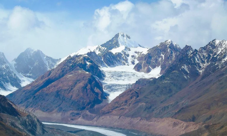
A long snow ridge above the Miyar valley.
Lahaul's second-highest summit, climbed from Urgos village over the Urgos pass and up a long east-northeast ridge of snow and ice. A serious glaciated 6,000er in the Himachal rain shadow, for climbers who want more than a trekking peak.
- 6,443 m summit (21,138 ft)
- About 3 weeks from Manali (estimate)
- Jun–Sep season
- Alpine AD snow and ice ridge
- Price Get Quote
Mountains of India › Himachal Pradesh › Menthosa
Last verified 11 Nov 2026
What is Menthosa, and how do you climb it?
Menthosa (6,443 m / 21,138 ft) is the second-highest peak in Lahaul, Himachal Pradesh, after Mulkila. It rises above Urgos village and the Miyar valley. The normal route crosses the Urgos pass and follows the long east-northeast ridge, graded about Alpine AD with 40–50° snow and ice. Climb it from June to September. See all the 6,000 m peaks of India.
Menthosa stands on the east side of the Miyar valley in Lahaul, above the village of Urgos (also spelled Urgus). At 6,443 m it is the second-highest peak in Lahaul: the Himalayan Journal noted that only Mulkila is higher in that part of the region. Published heights run from 6,440 m to 6,444 m; we use 6,443 m, the figure in the Indian Navy, American Alpine Journal and Mount Everest Foundation records.
It is not a trekking peak. The normal route is a long glaciated climb with sustained snow and ice slopes, crevasses and real cold above 6,000 m. This page sets out the route with approximate camp altitudes, the honest grade, the season, the permits and the climbing history from 1970 to the 2019 south-ridge traverse. For the wider picture, see our Indian Himalaya guide, the full list of India’s highest peaks and our guide to the peaks of Himachal Pradesh.
Route from Udaipur and Urgos, camp by camp
From Manali the drive goes through the Atal Tunnel (or over the Rohtang Pass) and down the Chandra valley to Udaipur (about 2,650 m), the old road-head near the mouth of the Miyar valley. Jeeps now reach Urgos (about 3,250 m); the Indian Navy team in 2018 started its climb from the village. The walk-in follows the Urgos nala to a grassy base camp beside a stream, about 4,400 m.
Camp 1 sits on the Urgos pass, at the foot of the east-northeast ridge. Above it the route climbs the north-east flank to Camp 2, then to a high camp about 200 m below the crest of the east ridge. Summit day follows the long east ridge over a broad hump near 6,200 m to the top. Teams place camps at different heights (base camp is recorded from about 4,400 m to 4,570 m), so the figures below are approximate.
| Camp / point | Altitude | Notes |
|---|---|---|
| Udaipur | 2,650 m / 8,694 ft | Old road-head in the Chandra valley, near the Miyar confluence |
| Urgos | 3,250 m / 10,663 ft | Village and today's jeep road-head; the walk-in starts here |
| Base camp | 4,400 m / 14,436 ft | Grass by a stream up the Urgos nala (about 4,400 m; other teams 4,470–4,570 m) |
| Camp 1 (Urgos pass) | 5,100 m / 16,732 ft | Pass at the foot of the east-northeast ridge (about 5,100 m; other teams 4,880–5,030 m) |
| Camp 2 | 5,650 m / 18,537 ft | On the north-east flank, sheltered by an ice shelf (about 5,650 m; 1973 team about 5,590 m) |
| High camp | 6,000 m / 19,685 ft | About 200 m below the east-ridge crest (1973 team about 6,190 m) |
| Menthosa summit | 6,443 m / 21,138 ft | Along the long east ridge; the 2018 Navy team took about 8.5 hours up from its top camp |
A typical plan (estimate, not a fixed schedule)
- Days 1–2 · ManaliArrive, sort permits, police registration and gear, and rest.
- Day 3 · Manali to UrgosDrive through the Atal Tunnel and the Chandra valley via Udaipur to the road-head at about 3,250 m.
- Days 4–6 · Walk-in to base campUp the Urgos nala in short stages to base camp at about 4,400 m, with an acclimatisation day.
- Days 7–9 · Camp 1 on the Urgos passRest, snow and ice training and load ferries to the pass at about 5,100 m.
- Days 10–13 · Camp 2 and high campUp the north-east flank to Camp 2, then to high camp at about 6,000 m.
- Day 14 · Summit dayAn early start along the east ridge to the 6,443 m summit, then down to a lower camp.
- Days 15–18 · Spare daysKept for weather, a second attempt and a careful descent.
- Days 19–21 · Back to ManaliWalk out to Urgos and drive back to Manali.
Itineraries vary with the outfitter, group and weather; rest days are added when needed.
How hard is Menthosa?
The normal route is graded about Alpine AD (assez difficile). Expect long, sustained snow and ice slopes of 40–50°, short steeper steps, up to 50–55° on the north-east flank, crevasses and temperatures around −20 °C above 6,000 m. The Indian Navy team in 2018 reported −25 °C on its summit push. Several strong teams have turned back below the top, in 1983, 1986 and 1994.
Arrive with an earlier 6,000 m summit and good crampon and rope skills. If you are not there yet, start with Yunam or Deo Tibba, read our guide to climbing your first 6,000 m peak, and plan your acclimatisation with our altitude sickness guide.
- ExperienceAt least one earlier 6,000 m summit, or a solid record on glaciated peaks.
- TechniqueCrampons and ice axe on 40–55° snow and ice, moving roped on a glacier and crevasse rescue.
- FitnessLoad carries between four camps and a long summit day above 6,000 m.
- AcclimatisationA gradual walk-in from Urgos and rest days at base camp and Camp 1.
- TrainingA Basic Mountaineering Course; Indian teams also follow IMF rules on team qualifications.
Best time to climb Menthosa
June to September. Lahaul lies in the Himalayan rain shadow, so the Miyar valley gets little monsoon rain. May and October are colder but possible. The recorded climbs show the spread: the 1973 team summited from 3 June, the 2019 south-ridge pair on 26 August, and the Indian Navy team on 16 October 2018.
Keep spare days for weather. Fresh snow makes the ridge slow and the flank prone to avalanche, and cold in October is severe.
| Jan | Feb | Mar | Apr | May | Jun | Jul | Aug | Sep | Oct | Nov | Dec |
BestPossibleClosed / not advised
Permits for Menthosa
Indian climbers need permission from the Indian Mountaineering Foundation (IMF) for an expedition. In Himachal, climbs go through an HP Tourism-registered outfitter with registered guides, with pre-trek police registration and insurance for every member under the state’s 2021 adventure rules.
Foreign nationals can climb Menthosa with IMF permission, applied for at least 90 days ahead, and a liaison officer. At 6,443 m it falls in the up-to-6,500 m band: a base fee of US$500 for a team of two, plus per-member charges and US$500 for liaison-officer equipment (IMF peak-fee page, checked Oct 2026). Lahaul is not on Himachal’s protected-area list, so no protected-area permit is needed. Visa rules can change, so confirm with the Indian mission. More in our IMF permit and peak fee guide and our guide to mountaineering in India for foreign climbers.
What a guided Menthosa expedition includes
The price depends on your dates, group size, nationality and experience, so we quote each expedition. Tell us your dates and climbing record on WhatsApp and you get one plan and one quote. Foreign nationals also pay the IMF fee and liaison-officer charges, shown separately.
- Certified mountaineering guides and support staff
- Tents, camps and all meals on the mountain
- Group climbing equipment (ropes, fixed lines and anchors)
- Help with IMF permission and permit paperwork
- Transfers from Manali to Urgos and back
- Acclimatisation and weather days in the plan
What to pack
- Insulated mountaineering boots that take crampons
- Crampons, an ice axe and a jumar (ascender)
- Climbing harness, helmet, carabiners, slings and a belay device
- Expedition down jacket and a sleeping bag rated well below −20 °C
- Windproof and waterproof shell jacket and trousers
- Summit mitts plus liner gloves
- Glacier sunglasses (UV400), goggles and sunscreen
- Headlamp with spare batteries
- Trekking poles for the walk-in
- Two water bottles and a personal first-aid kit
Climbing history of Menthosa
The first ascent was made in 1970 by a British services expedition led by Capt S. Bembrose. Lt S. Rae (Royal Marines) and Capt R. Cape (REME) reached the summit by the east-northeast ridge. The trip had a close call: a member, Bob Steward, was hit by falling ice and flown out by helicopter from base camp. In 1973 the Army Mountaineering Association (UK), led by Maj J. W. Fleming, put its first pair on top on 3 June 1973, and all 18 members summited over the next six days.
Not every team got up. Dave Challis and Aloke Surin turned back at about 6,250 m in 1983, Surin returned in 1986 and wrote ‘Menthosa; Almost’, and a Royal Air Force team reached 6,257 m in 1994. On 16 October 2018 a ten-member Indian Navy team led by Lt Cdr Shivesh Kumar Sanam summited after leaving its top camp at 2 a.m. On 26 August 2019 Spencer Gray and Sachin Nanavatty made the first ascent of the south ridge and the first traverse of the mountain, more than 8 km, graded ED2 WI4 M6.
Other Himachal Pradesh peaks of a similar height
-
Himachal Pradesh6,446 m21,148 ft
Dharamsura
-
Himachal Pradesh6,451 m21,165 ft
Papsura
-
Himachal Pradesh6,473 m21,237 ft
Jorkanden
-
 Himachal Pradesh
6,517 m21,381 ft
Mulkila
Menthosa: questions people ask
How high is Menthosa?
6,443 m (21,138 ft). Published figures range from 6,440 m to 6,444 m.
Where is Menthosa?
In Lahaul, Himachal Pradesh, above Urgos village and the Miyar valley. Udaipur is the old road-head; jeeps now reach Urgos.
Who first climbed Menthosa?
A British services team led by Capt S. Bembrose, in 1970. Lt S. Rae and Capt R. Cape reached the summit by the east-northeast ridge.
How difficult is Menthosa?
It is a glaciated climb graded about Alpine AD: long 40–50° snow and ice slopes on the east-northeast ridge, crevasses and strong cold. An earlier 6,000 m summit is wise.
Is Menthosa higher than Mulkila?
No. Mulkila (6,517 m) is higher; Menthosa is the second-highest peak in Lahaul.
What is the best time to climb Menthosa?
June to September. Lahaul lies in the rain shadow, so the monsoon is weak there; May and October are possible but colder.
Do foreigners need a permit for Menthosa?
Yes: IMF permission applied for at least 90 days ahead and a liaison officer. The up-to-6,500 m band is US$500 for a team of two (Oct 2026), plus other charges. No protected-area permit is needed for Lahaul.
How many days does a Menthosa expedition take?
There is no official figure. About three weeks from Manali is a common estimate, including weather days.
Plan this climb with Suzu
We pair you with a registered Himachal outfitter and certified guides, sort the permits and add hotel and transfers — one plan, one quote.
Keep exploring
 Reo Purgyil6,816 m · the highest peak in Himachal, above NakoDeo Tibba6,001 m · the snow dome above Jagatsukh and the Duhangan Col
 Hanuman Tibba5,982 m · the technical snow pyramid above Beas KundPeaks of Himachal Pradesh28 peaks · Reo Purgyil 6,816 m to ChurdharMountains of IndiaRecords, permits and trainingHighest peaks in IndiaFull list of 161 peaksGuided peak climbsFriendship Peak to Deo Tibba
Sources
- SummitPost — Menthosa (1983 account and approach)
- American Alpine Journal 2020 — Menthosa, South Ridge and Traverse
- Himalayan Journal 43 — Menthosa; Almost
- Himalayan Journal 33 — Army Mountaineering Association Himachal Pradesh Expedition 1973
- Mount Everest Foundation — RAF Menthosa 1994
- Indian Navy — SNC mountaineering team summits Mt Menthosa (2018)
- Indian Mountaineering Foundation — peak fees for foreign expeditions
- HP Kinnaur district — tourism guide (protected areas)
- Wikipedia — List of mountain peaks of Himachal Pradesh
Photo credits
Mulkila and its glacier — Photo: Bharatkaistha, CC BY-SA 4.0 · Leo Pargial and Reo Purgyil — Photo: Arashdeep, CC BY-SA 4.0 · Hanuman Tibba above Solang — Photo: Biswarup Ganguly, CC BY 3.0